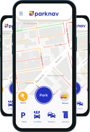


Parking Solutions
Parknav®’s Parking Availability Map uses patented award-winning machine learning technology to determine most precisely streets with at least 1 open and legal on-street parking space, especially the “hard to park” streets.
Details
- Technology developed for over 25 years by a globally recognized award winning data science team to bring the most accurate real-time availability
- Real-time availability information is updated every minute
- Ability to choose between free, paid and permit on-street parking types
- Takes into account parking restriction information, such as areas where it is illegal to park
- *Probabilities for each street are calculated from intersection to intersection
Benefits
- Saves up to 67% of your time looking for on-street parking
- Allows you to see parking availability for every street within a specified area
Technical
- Works for all mapping platforms
- Easy to integrate JSON/GeoJSON API for any mapping platform


Parknav® offers valuable insights on parking restrictions, including locations, days, times, zones, and rates in a city
Discover where and when you can park legally, and whether payment is required.
Details
Includes restriction information for:
- No parking allowed (days/times)
- Free parking (days/times), incl. # of spaces
- Paid parking (days/times/zones/rates), incl. # of spaces
- Permit parking (days/times/zones), incl. # of spaces
- EV parking (days/times/rates)
- Handicap parking (days/times)
- Easy to integrate JSON/GeoJSON API for any mapping platform
Benefits
- Up-to-date restriction information that is more accurate than most city and mobile payment providers
- Takes the guesswork out of knowing whether you are parked legally or illegally
- Enables you to know what pay zone they parked in and how much they will need to pay
- Great for autonomous vehicles needing to understand the on-street parking restriction landscape
Technical
- Works for all mapping platforms
- Easy to integrate JSON/GeoJSON API for any mapping platform


Parknav®’s Best Area helps users find areas in the city with the most open on-street parking and free parking spaces.
Trying to choose a restaurant with parking nearby? Use Parknav® to help narrow down your selection to areas with the highest concentration of open parking spaces.
Details
Includes restriction information for:
- Real-time dynamic information is updated every minute
- Takes into account parking restriction information, such as areas where it is illegal to park
Benefits
- Provides insights that can help you determine which restaurant, store, etc they want to visits based on the concentration of available on-street parking.
Technical
- Works for all mapping platforms
- Easy to integrate JSON/GeoJSON API for any mapping platform


Parknav®’s Parking Events identifies the specific location(s) of individual parking spaces that have recently become available throughout the city.
It uses advanced algorithms and real-time data to pinpoint the exact locations of available spots.


Parknav’s Parking Availability Map uses patented award winning machine learning technology to determine most precisely streets with at least 1 open and legal on-street parking space, especially the “hard to park” streets.
Details
- Technology developed for over 25 years by a globally recognized award winning data science team to bring the most accurate real-time availability
- Real-time availability information is updated every minute
- Ability to choose between free, paid and permit on-street parking types
- Takes into account parking restriction information, such as areas where it is illegal to park
- *Probabilities for each street are calculated from intersection to intersection
Benefits
- Saves up to 67% of your time looking for on-street parking
- Allows you to see parking availability for every street within a specified area
Technical
- Works for all mapping platforms
- Easy to integrate JSON/GeoJSON API for any mapping platform
Parknav’s Parking Restrictions provides the locations, days, times, zones and rates of various curb regulation types throughout a city.
See where and when it is legal and illegal to park and whether or not you will need to pay.
Details
Includes restriction information for:
- No parking allowed (days/times)
- Free parking (days/times), incl. # of spaces
- Paid parking (days/times/zones/rates), incl. # of spaces
- Permit parking (days/times/zones), incl. # of spaces
- EV parking (days/times/rates)
- Handicap parking (days/times)
- Easy to integrate JSON/GeoJSON API for any mapping platform
Benefits
- Up-to-date restriction information that is more accurate than most city and mobile payment providers
- Takes the guesswork out of knowing whether you are parked legally or illegally
- Enables you to know what pay zone they parked in and how much they will need to pay
- Great for autonomous vehicles needing to understand the on-street parking restriction landscape
Technical
- Works for all mapping platforms
- Easy to integrate JSON/GeoJSON API for any mapping platform
Parknav’s Best Area allows users to identify areas with the highest concentration of open parking spaces throughout the city.
Trying to choose a restaurant with parking nearby? Use Parknav to help narrow down your selection to areas with the highest concentration of open parking spaces.
Details
Includes restriction information for:
- Real-time dynamic information is updated every minute
- Takes into account parking restriction information, such as areas where it is illegal to park
Benefits
- Provides insights that can help you determine which restaurant, store, etc they want to visits based on the concentration of available on-street parking.
Technical
- Works for all mapping platforms
- Easy to integrate JSON/GeoJSON API for any mapping platform
Parknav’s Parking Events identifies the specific location(s) of individual parking spaces that have recently become available throughout the city.
Want to learn more?
Want to find parking? Let’s talk!

We’d love to hear from you and help solve all your parking needs – from finding available spots, to restrictions, traffic control, smart city information or just to talk about parking itself.